
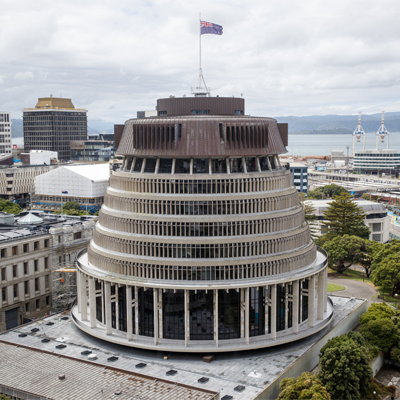
Wellingtonweather
- Updated
- Sunrise:
- Sunset:
15°C
- 15°C11°C
Mainly fine with passing cloud. Strong northerlies, easing this evening.
- 16°C12°C
Mainly fine with morning and evening cloud. Northerlies, becoming strong in the afternoon.
- 16°C11°C
Fine. Strong northerlies.
For more detailed weather information visit MetService.
Marine Recreational Forecasts - Wellington
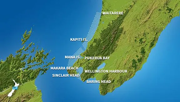
Area Description:
Wellington, Mana
Situation:
A ridge of high pressure dominates northern and central New Zealand today and tomorrow. Meanwhile, a weak front moves across the lower South Island today. Later tomorrow a warm front moves onto Fiordland from the Tasman Sea. During Tuesday, a front moves northeast to the east of the South Island, while a ridge of high pressure covers much of the nation. On Wednesday, a northerly flow strengthens over the south of the South Island while a ridge covers the remainder. A front moves north over South Island on Thursday while a ridge weakens over the North Island.
Warnings:
Strong wind advisory
Forecasts:
For Wellington:
Today: Northerly 25 knots gusting 35 knots, easing to 20 knots gusting 30 knots this evening. Rough sea easing this evening. Partly cloudy. For the South Coast and Palliser Bay: Southerly swell 1 metre. For Castlepoint: Southerly swell 2 metres easing to 1.5 metres.
For Mana:
Today: Northerly 20 knots gusting 30 knots, easing to 15 knots in the evening. Moderate sea easing in the evening. Cloudy periods. Westerly swell 1 metre developing.
Outlook:
For Wellington:
Monday: Northerly 20 knots gusting 30 knots, rising to 25 knots gusting 35 knots in the afternoon. Sea becoming rough in the afternoon. Cloud clearing to fine in the afternoon. For the South Coast and Palliser Bay: Southerly swell 1 metre easing to half a metre. For Castlepoint: Southerly swell 1.5 metres easing to 1 metre.
Tuesday: Northerly 25 knots, easing to 15 knots in the afternoon. Fine. For the South Coast and Palliser Bay: Southerly swell half a metre dying out. For Castlepoint: Southerly swell 1 metre.
Wednesday: Northerly 15 knots, easing to variable 5 knots early. Becoming northerly 20 knots later. Fine. For the South Coast and Palliser Bay: Southerly swell 2 metres developing. For Castlepoint: Southerly swell rising to 2 metres.
Thursday: Northerly 25 knots. Partly cloudy. For the South Coast and Palliser Bay: Southerly swell easing to 1 metre. For Castlepoint: Southerly swell 2 metres easing.
For Mana:
Monday: Northerly 15 knots, rising to 20 knots gusting 30 knots in the morning. Sea becoming moderate in the morning. Cloud clearing to fine in the afternoon. Westerly swell 1 metre dying out.
Tuesday: Northerly 20 knots. Fine. Westerly swell 1 metre developing.
Wednesday: Northerly 15 knots. Fine. Northwest swell 1 metre dying out.
Thursday: Northerly 20 knots. Cloud clearing and becoming fine. Southwest swell 1 metre developing.
Swell:
Marine Coastal Forecasts - Cook
Forecast:
Sunday: Northwest 30 knots, easing to 20 knots in the evening. Rough sea easing. Southerly swell 1 metre.
Outlook:
Outlook following 3 days:
Monday: Northerly 20 knots, rising to 35 knots south of Cape Terawhiti in the afternoon. Sea becoming very rough in the south. Southerly swell 1 metre.
Tuesday: Northwest 25 knots but northerly 35 knots south of Cape Terawhiti. Easing to northerly 20 knots everywhere in the morning. Very rough sea in the south easing.
Wednesday: Northeast 20 knots, easing to northerly 10 knots early, rising to 25 knots later. Sea becoming rough. Southerly swell becoming moderate.
Thursday: Becoming northwest 25 knots but northerly 35 knots south of Cape Terawhiti early. Sea becoming very rough in the south. Moderate southerly swell easing.
Marine Coastal Forecasts - Castlepoint
Forecast:
Sunday: Northwest 15 knots, but 25 knots south of Cape Palliser, easing to 15 knots everywhere late evening. Sea becoming rough for a time in the south. Southwest swell 2 metres, easing.
Outlook:
Outlook following 3 days:
Monday: Northwest 10 knots, rising to northerly 20 knots in the afternoon. Becoming northerly 35 knots south of Cape Palliser in the evening. Sea becoming very rough in the south. Southwest swell 1 metre. Northwest swell 1 metre developing south of Cape Palliser.
Tuesday: Northwest 25 knots but 35 knots south of Cape Palliser. Rising to northwest 35 knots everywhere in the morning, then easing to westerly 15 knots in the afternoon. Becoming variable 10 knots in the evening. Very rough sea at times.
Wednesday: Variable 10 knots, becoming northeast 20 knots later. Southerly swell becoming moderate.
Thursday: Northerly 20 knots. Moderate southerly swell easing.