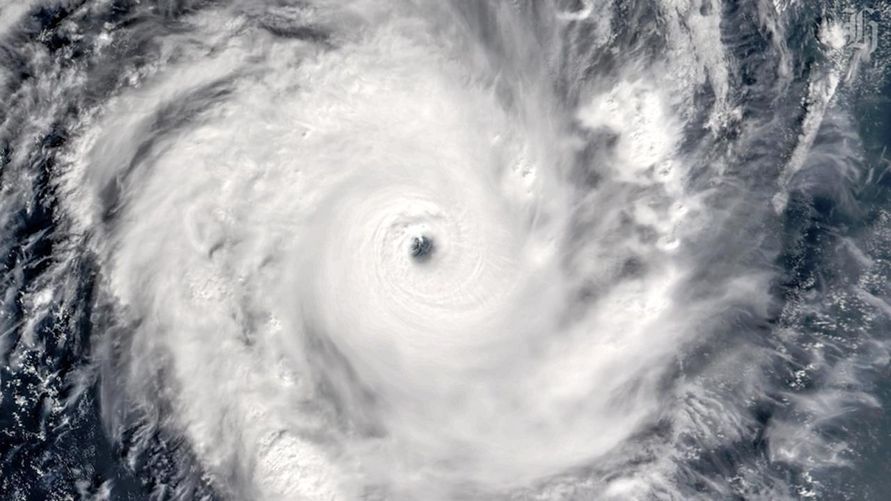
Gale-force winds - or those higher than 63km/h - are found at low levels near their swirling centres but can fan out for hundreds of kilometres.
Meteorologists consider a "severe tropical cyclone" one that blasts as hard as 118km/h.
Gita is expected to be upgraded to category 5 - the highest grading possible, and one where wind speeds are greater than 196km/h.
Each year, over the November-to-April season, about 10 tropical cyclones form in the Southwest Pacific basin.
Only a few of those ever reach category 4 strength, where mean wind speeds are more than 159 km/h, or higher.
Vanuatu and New Caledonia typically experience the greatest activity, with an average of two or three named cyclones passing close to land each year.
This season, it had been forecast New Caledonia, Fiji, Vanuatu and Tonga, could see two or more, while three or four severe cyclones of category 3 or higher were expected anywhere across the region.
At least one comes within 550km of New Zealand each year, usually around February and March.
To get down here, they had to make their way over much colder waters, while hitting strong upper level winds as they moved out of the tropics.
By the time they arrived, they were almost always re-classified as "ex-tropical" cyclones.
That didn't mean they'd weakened or been downgraded, but had morphed into a completely different type of beast.
And ex-tropical cyclones could still pack the potential for severe weather.
Under the right conditions, they could intensify and even muster lower pressures than they had before being re-classified.
Many of our most severe storms - such as last April's Debbie, which brought the deluge that pushed a Rangitaiki River stopbank to breaking point, flooding Edgecumbe - have been ex-tropical cyclones.
In the tropics, the strongest winds and most intense rain associated with a tropical cyclone usually occurred just outside the "eye", or cyclone centre.
But after it had been transformed in what's call an "extra-tropical transition", the systems lost their symmetric cloud patterns.
The strongest winds and heaviest rain could then be found hundreds of kilometres from the cyclone's centre - usually in a large area south of the centre.
For meteorologists, that meant the position of the cyclone centre was no longer a good indicator of where the most severe weather would hit.
In 1988's catastrophic Cyclone Bola, for example, the heaviest rain and strongest winds over New Zealand occurred well away from the centre.
Across the world, there are six "regional specialised meteorological centres", or RSMCs, and six "tropical cyclone warning centres", or TCWCs, which are responsible for putting out advisories and bulletins in their regions.
MetService runs the Wellington TCWC, which monitors an area that stretches over the North Island and hundreds of kilometres east.
Tropical cyclone specialists track systems using several "ensemble" models that combine global and high-resolution regional models.
One pulls together more than 50, while another combines more than 100.
Model "runs" are made twice a day, which forecasters use to produce new bulletins, and over busy periods, forecasters monitor the situation day and night.
The stronger that co-relating patterns in the models became, the more confident forecasters were in predicting where tropical cyclones would move around the region.
Unsurprisingly, the further out forecasters looked, the less clear the picture was.
Metservice meteorologist Mickey Malivuk said models clearly showed Gita tracking towards New Caledonia later this week, and most indicated it would swing southeast towards New Zealand early next week.
"But then they all diverge a bit."
It was still too early to tell where in New Zealand the system would make landfall - and it was still possible Gita might just carry on rolling westward.
"It's still a fair way out for us to be sure."
Niwa has predicted ex-tropical cyclones will likely become stronger under climate change, and cause more damage as a result of greater wind speeds and heavier rainfall.
Climate scientists also predict there will be fewer of them.
"As time goes on, the number of tropical cyclones - and the number of storms generally - is likely to decrease a little," Victoria University climate scientist Professor James Renwick said.
"But, when we get one of these things, they'll likely be stronger, with lower central pressure, stronger winds, and definitely more rainfall, because there is more moisture in the air."
The drop in frequency could be explained by changes in the state of the atmosphere that would result in fewer storms being required to maintain the flow of heat from the tropics to the poles.
"It's like the intensity gets concentrated into less events," Renwick said.
"Although, we are not talking vast changes - only a few percentage points - so while we get an average 10 tropical cyclones each season today, it might be around nine in the future."


