
Whakatāneweather
- Updated
- Sunrise:
- Sunset:
19°C
- 22°C17°C
Periods of rain, sometimes heavy. Northeasterlies.
- 23°C16°C
A few showers, easing to the odd shower in the morning. Light winds, then southeasterlies developing in the evening.
- 24°C19°C
Fine, but becoming cloudy in the morning. Southeasterlies, becoming strong for a time in the afternoon and evening.
For more detailed weather information visit MetService.
Marine Recreational Forecasts - Whakatāne
Area Description:
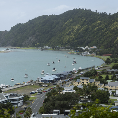
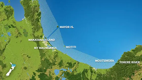
Bay of Plenty
Situation:
A slow moving front lies over the northeastern North Island, while a trough lies over the South Island. Tomorrow, the trough moves away as a ridge of high pressure spreads across central New Zealand, and another front approaches the far south of the South Island late in the day. Cyclone Vaianu is forecast to track southwards and approach eastern Northland, then move south to southeast across the North Island during Sunday. Several Severe Weather Watches have already been issued for this multi-hazard, potentially life-threatening event, and it's likely many of these will be upgraded to Orange Warnings, with the possibly of some Red Warnings. Other regions not already covered by a Watch may be added depending on the track of the cyclone. Cyclone Vaianu is forecast to move away to the southeast of New Zealand Monday morning, followed by a series of fronts embedded in a westerly flow.
Warnings:
Forecasts:
For Bay of Plenty:
Today: Variable 5 knots. Northeast 10 knots developing in the evening. Sea slight. Cloudy. Poor visibility in showers, possibly heavy. Northerly swell 2 metres rising to 2.5 metres.
Outlook:
For Bay of Plenty:
Friday: Northeast 10 knots, easing to variable 5 knots in the morning. Northeast 15 knots developing in the afternoon, changing southeast 20 knots but 10 knots east of Moutohora Island in the evening. Sea becoming moderate in the west in the evening. Mostly cloudy, with fair visibility in a few showers. Northerly swell 2.5 metres.
Saturday: Southeast 20 knots but 10 knots east of Moutohora Island. Becoming southeast 25 knots everywhere in the morning. A few showers developing. Northeast swell rising to 3 metres.
Sunday: Easterly 30 knots, rising to 40 knots early. Becoming northwest 40 knots later. Rain easing. Northeast swell rising to 4 metres.
Monday: Easing to northwest 25 knots early, then to 15 knots later. Showers clearing. Northerly swell 4 metres easing.
Swell:
Marine Coastal Forecasts - Plenty
Forecast:
Thursday: Northeast 15 knots. Sea slight. Northeast swell 2 metres. Poor visibility in periods of rain.
Outlook:
Outlook following 3 days:
Friday: Northeast 10 knots. Becoming easterly 15 knots but 25 knots offshore in the afternoon. Sea becoming rough offshore. Northeast swell rising to 3 metres. Fair visibility in showers.
Saturday: Southeast rising to 20 knots but 35 knots offshore in the morning. Becoming easterly 35 knots everywhere in the afternoon. Sea becoming very rough. Northeast swell becoming heavy.
Sunday: Easterly 35 knots, rising to northeast 45 knots early. Becoming northwest 40 knots later. Sea becoming high for a time. Heavy northerly swell easing for a time.
Monday: Northwest 35 knots, easing to 25 knots early, then to 15 knots late. Very rough sea easing. Heavy northerly swell dying out. Moderate easterly swell developing.