
Taurangaweather
- Updated
- Sunrise:
- Sunset:
18°C
- 23°C17°C
Mostly cloudy with the odd shower. Easterlies developing in the morning.
- 24°C19°C
Cloudy, then a period of rain with heavy falls in the afternoon and evening. Southeasterlies, becoming strong in the morning.
- 23°C18°C
Rain becoming persistent with heavy falls in the morning. Strong southeasterlies, turning southwesterly in the afternoon.
For more detailed weather information visit MetService.
Marine Recreational Forecasts - Tauranga
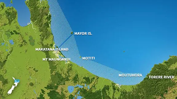
Area Description:
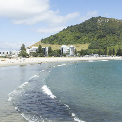
Bay of Plenty
Situation:
A narrow ridge of high pressure lies over central New Zealand today and tomorrow. Cyclone Vaianu approaches the upper North Island to lie just northeast of Northland by late Saturday, while a front approaches Fiordland from the west. Cyclone Vaianu is expected to move south across the North Island during Sunday. Several Severe Weather Watches are already issued for this multi-hazard event, and it's likely many of these will be upgraded to Orange Warnings, with Red Warnings also possible. Regions not already covered by a Watch may be added depending on the track of the ex-cyclone. Cyclone Vaianu is forecast to move away to the southeast of New Zealand Monday morning, followed by a series of fronts embedded in a westerly flow. On Tuesday, a low from the Tasman Sea approaches southern New Zealand with associated fronts moving across the country.
Warnings:
Strong wind advisory
Forecasts:
For Bay of Plenty:
Today: Variable 5 knots. Southeast 10 knots developing for a time in the morning. Northeast 15 knots developing in the afternoon, changing southeast 20 knots early evening. Rising to southeast 25 knots gusting 35 knots west of Moutohora Island late evening. Sea becoming rough in the west in the evening. Mostly cloudy, with poor visibility in a few showers. Northerly swell 2.5 metres.
Outlook:
For Bay of Plenty:
Saturday: Southeast 25 knots gusting 35 knots but 20 knots east of Moutohora Island. Becoming southeast 25 knots gusting 35 knots everywhere in the morning. A few showers developing. Northeast swell 2.5 metres rising to 3 metres.
Sunday: Easterly 30 knots, rising to 40 knots early. Becoming northwest 40 knots later. Rain easing. Northeast swell rising to 4 metres.
Monday: Easing to northwest 25 knots early, then to 15 knots later. Showers clearing. Northerly swell 4 metres easing.
Swell:
Marine Coastal Forecasts - Plenty
Forecast:
Friday: Variable 10 knots. Easterly 15 knots developing this morning, rising to 25 knots offshore in the afternoon. Becoming easterly 25 knots everywhere in the evening. Sea becoming rough. Northeast swell rising to 3 metres. Poor visibility in showers.
Outlook:
Outlook following 3 days:
Saturday: Easterly 25 knots. Becoming southeast 25 knots but 35 knots offshore in the morning. Becoming easterly 35 knots everywhere in the afternoon. Sea becoming very rough. Northeast swell becoming heavy.
Sunday: Easterly 35 knots, rising to northeast 45 knots early. Becoming northwest 40 knots later. Sea becoming high for a time. Heavy northerly swell easing for a time.
Monday: Northwest 35 knots, easing to 25 knots early, then to 15 knots late. Very rough sea easing. Heavy northerly swell dying out. Moderate easterly swell developing.