
Tauranga
At
12°C
- Sunrise:
- Sunset:
Mainly fine with evening high cloud. Westerlies, easing at night.
Periods of rain developing before dawn, possibly heavy until evening. Easterlies, turning southerly in the evening.
Partly cloudy, with the chance of a shower until evening. Southerlies, becoming strong for a time in the morning.
For more detailed weather information visit MetService.
Marine Recreational Forecasts - Tauranga
Area Description:
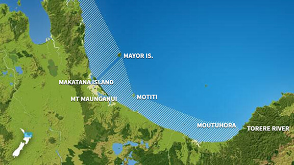
Bay of Plenty
Situation:
A low in the northern Tasman Sea approaches the northern North Island, while a weak ridge of high pressure covers the rest of the country. Tomorrow, the low moves east across the North Island, while a ridge covers much of the South Island. A weakening front moves east onto the lower South Island on Friday. Over the weekend, a ridge builds over the South Island, while a showery southerly flow affects the North Island.
Warnings:
Strong wind advisory
Forecasts:
For Bay of Plenty: Today: Westerly 15 knots, easing to variable 5 knots in the evening. Sea slight. Cloudy periods. Northerly swell 1.5 metres easing to half a metre.
Outlook:
For Bay of Plenty: Thursday: Variable 5 knots. Easterly 20 knots but 30 knots gusting 40 knots west of Moutohora Island developing in the morning, becoming southeast 20 knots everywhere in the afternoon, before turning southerly 20 knots in the evening. Sea becoming rough in the west for a time in the morning and afternoon. Poor visibility in rain developing around midday, heavy at times, easing to showers by evening. Northerly swell half a metre rising to 1.5 metres. Friday: Southerly 20 knots, easing to 15 knots in the afternoon. A few showers. Northerly swell 1 metre dying out. Saturday: Southwest 10 knots, turning southeast 10 knots late. Partly cloudy. Sunday: Southerly 10 knots. Fine.
Swell:
Marine Coastal Forecasts - Plenty
Forecast:
Wednesday: Westerly 20 knots, easing to variable 10 knots in the evening. Moderate sea easing. Northwest swell 2 metres easing. Southeast swell 2 metres offshore easing.
Outlook:
Outlook following 3 days: Thursday: Variable 10 knots. Northeast 30 knots developing in the morning, then becoming northwest 15 knots but easterly 25 knots near shore around midday. Becoming southerly 20 knots everywhere in the evening. Sea becoming rough for a time. Northwest swell rising to 2 metres. Southeast swell 1 metre offshore. Poor visibility in rain developing in the morning, easing to showers in the afternoon. Friday: Southerly 20 knots, easing to 10 knots in the evening. Moderate northwest swell dying out. Saturday: Southwest 15 knots. Sunday: Southerly 15 knots.