

Can you pinpoint Tuatapere on a map? You might be in a minority of people who can, writes Thomas Bywater
Over the past 24 months, as New Zealanders, we’ve been encouraged to do something new and explore different parts of our backyard. But just how good is our collective sense of direction? It seems parts of the motu are still a mystery.
In a quest to test how well you know New Zealand we asked Herald readers to play our Tiki Tour test. Tens of thousands of you responded and stuck a digital pin in the map. Some guesses were closer than others.


The closest guesses ranged from an average 44km off the mark to an enormous 5,207km. They took anywhere between 3 and 8 seconds to place. After which point guesses are not much more than that, a blind stab at the map.
There are landmarks that loom larger in the mental map than others. It took most just three seconds to point out Egmont / Mt Taranaki. Similarly speedy was Taupō, although the average guess was a little wider off the mark. (120km out, versus 53km for the Maunga.)
However, it appears that Southland was the biggest mystery to the Herald readership. The further from Bluff and Invercargill, the less certain we were about these places.
Never mind “Where did Kupe first make land?”
“Where exactly is Ruapuke Island?” is an enigmatic riddle for the ages.
Least known places: mapped
Select the views to see all 244 places ranked in order of difficulty to find.
The key thing that dictates how well we know a place is not population, not climate but travel.
Mapping 244 places and increasing their size in proportion to the speed and accuracy with which they could be found, we see the towns on popular travel routes balloon.

Auckland occupies as much space in our awareness as Akaroa, in spite of having 1.5 million fewer residents.
Proximity to a large city, or a well known landmark helps of course. However we find the towns passed through on the A to B and popular stop-overs occupy equal billing with the places at the end of the roads.
New Zealand's best known places mapped
Picton - the number 1, easiest found city - shows this clearly. The middle point in the motu, is easily found on a map as the gateway between islands.
The North Island swells - particularly surrounding Auckland and the Bay of Plenty, and the towns surrounding Wellington.
The South Island shrivels - especially as it tapers off towards the bottom around more remote parts of Fiordland and Otago.
However, if we flip this on its head and increase the size of towns by how difficult it was for Kiwis to find them, the picture is starker.
The nodes at the end of the road shrink, and we see more clearly the gaps in our knowledge.

New Zealand's worst known places mapped


New Zealand's best known places mapped
New Zealand's best known places mapped

New Zealand's worst known places mapped
New Zealand's worst known places mapped
Picton Pinpoint precise
The centre of New Zealand might as well be the centre of the universe. Picton landed top of the ranking for best known location.
With an average guess out by just 44km, the natural harbour and arrival point into the South Island was the easiest found spot in New Zealand.
Where is Picton?
This was not a surprise to Jacqui Lloyd GM for Destination Marlborough.
“It’s an access point and one of the main bridges between the North and South Islands,” she said, adding that it was “brilliant news” if not unexpected.
Picton scored equally well with North and South Islanders.


Queen Charlotte Sound and Picton hold a special place in the minds of New Zealanders. Photo / 123RF
Queen Charlotte Sound and Picton hold a special place in the minds of New Zealanders. Photo / 123RF
“Whether catching the Interislander ferry or exploring the Marlborough Sounds, it’s a place that many New Zealanders are aware of and have passed through.”
Domestic visitors made up about 60 per cent of visitors before the pandemic. While there had been quiet periods during travel restrictions - it is on the radar of tourists and other travellers passing through the port of Picton.


Hump Ridge Track
Hump Ridge Track
Putting Tuatapere on the map
Apart from Invercargill - which was the fifth quickest found town - much of Southland was a mystery.
Nine out of 10 of the bottom ranked places on the map were located in the region.
The south of the South Island was bottom of the pile in terms of our ability to find places.
Some of the more remote and lesser visited parts of the Country are found in Fiordland and the South Coast of te Waipounamu.


Doubtful Sound and Secretary Island
Doubtful Sound and Secretary Island
Secretary Island in deepest Fiordland ( average of 640 km off the mark, and a mode of 1226) was one. The island in Doubtful Sound has a long pre-European history and holds a special place for conservation. Still there are not many people who can find it on a map. Possibly because it is very hard to get to and there are few tour companies apart from Real Journeys, who will take you there.
Between Tokenui, Orepuki and Tuatapere, people trying to find the Southland towns were out by an average of 760 km. That’s not to say there isn’t anything of interest along the Foveaux Strait.
Where is Orepuke?
From petrified forests and the Catlins coastal route, there are several attractions that New Zealanders would love to visit but they’d be hard pressed to locate.
There are plenty of projects aimed at increasing the profile of New Zealand’s southernmost places. One of the most ambitious is based in Tuatapere.
The Hump Ridge Track was begun in 2001 as a way to bring tourists into the area which had previously been full of logging mills. Hiking out of Te Waewae bay it was widely considered one of New Zealand’s hidden gems for trampers. This could soon change.
Where is Tuatapere?
In 2019 it was selected for Great Walk status by the Department of Conservation.
“There has already been an increase in usage of the Tuatapere Hump Ridge Track since the 2019 Great Walk announcement,” said Aaron Fleming, DoC’s Southern South Island Director.
“Turning the Hump Ridge Track into a Great Walk means elevating it to the status of walks such as the Routeburn, Milford Track and Tongariro Northern Circuit.”
He hopes The newfound status is will do more than put “Tuatapere on the map” but also “bring recreation, conservation, and economic benefits to the region.”
Ruapuke Island was New Zealand's hardest to locate landmark. With guesses out by an average of 5200km, you can stop guessing.
You'll find it hidden between the better known landmarks of Bluff and Stewart Island.
Where is Ruapuke Island?
The place fewest New Zealanders could find on a map is at the very edge of the map. Tucked between Bluff and Rakiura / Stewart Island, the Ruapuke is hidden in the shadow of the better known Southland landmarks.
Uninhabited apart from some beehives, rare yellow-eyed penguins and a lone cannon - captured by Ngāi Tahu chief Tūhawaiki.
The island of 'two hills' is now privately owned by the descendants of Tūhawaiki.
Where is Ruapuke Island


Ruapuke Island seen from Slope Point, Southland. Photo / Andrewdp, Flickr
Ruapuke Island seen from Slope Point, Southland. Photo / Andrewdp, Flickr

Related links from NZ Herald
-
 Eliza McCartney - Raising the bar
-
 NZ's Greatest Olympians: Peter Snell
-
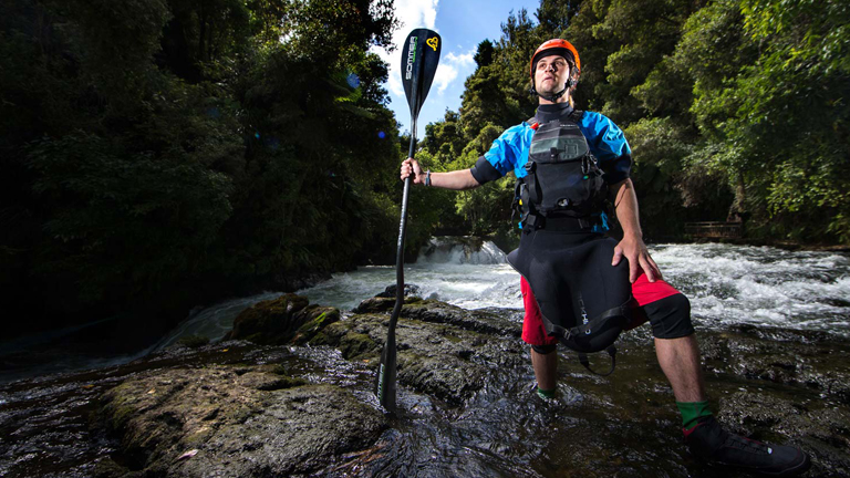 The River People
-
 The Longest Goodbye
© Copyright 2017 NZ Herald