

'GET EYES IN
THE AIR ASAP'
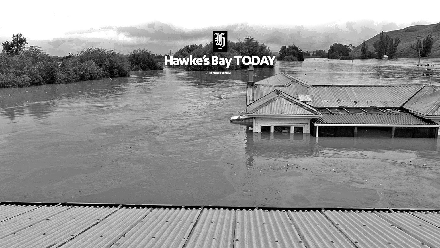

Inside Civil Defence as
Hawke's Bay flooded


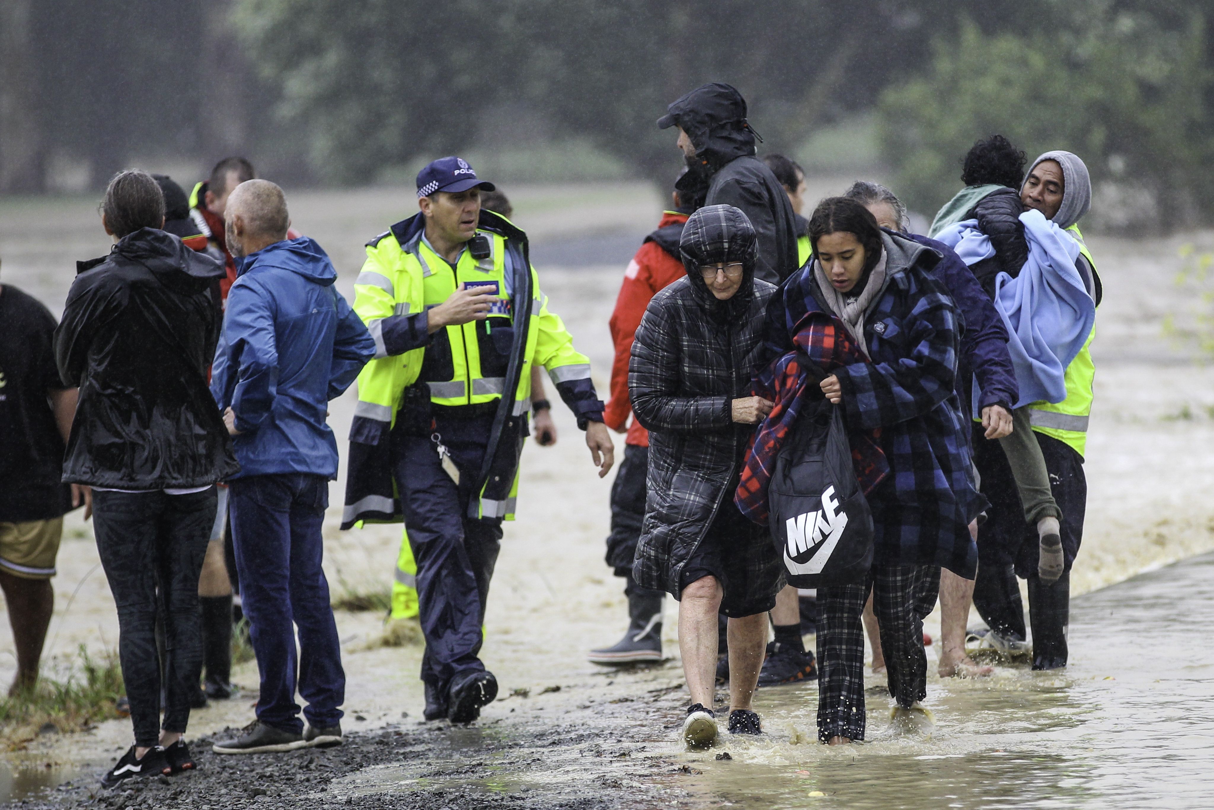
A rescue on Links Rd on the morning Cyclone Gabrielle hit Hawke's Bay. Photo Paul Taylor, Hawke's Bay Today.
A rescue on Links Rd on the morning Cyclone Gabrielle hit Hawke's Bay. Photo Paul Taylor, Hawke's Bay Today.
The review into Civil Defence's response to Cyclone Gabrielle in Hawke's Bay is set to be released this afternoon.
Hawke’s Bay Today has read through thousands of pages of official Civil Defence communications as it swept through the region.
What follows is a timeline that sheds light on what officials were thinking in the days prior, and how they reacted as water overwhelmed stopbanks across the region.


February 9, 2023
12:54pm: Email from a Hawke's Bay Regional Council (HBRC) Flood Forecaster to HBRC Incident Response Manager and Hawke's Bay Civil Defence and Emergency Management (HBCDEM) Group Office:
"The forecast oncoming weather certainly looks very bad for some parts of NZ. For Hawke’s Bay, Met Service are currently predicting heavy rain with high confidence for Tuesday. We’ll continue to watch and update."
2:32pm: HBCDEM Alternate Group Controller to CDEMGroup Office staff

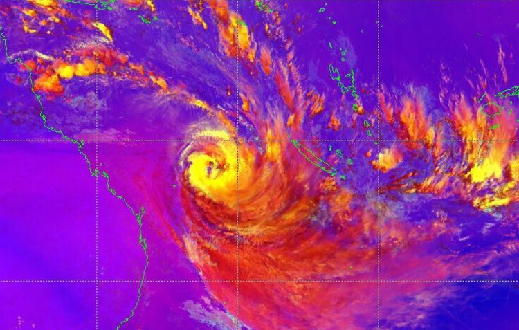
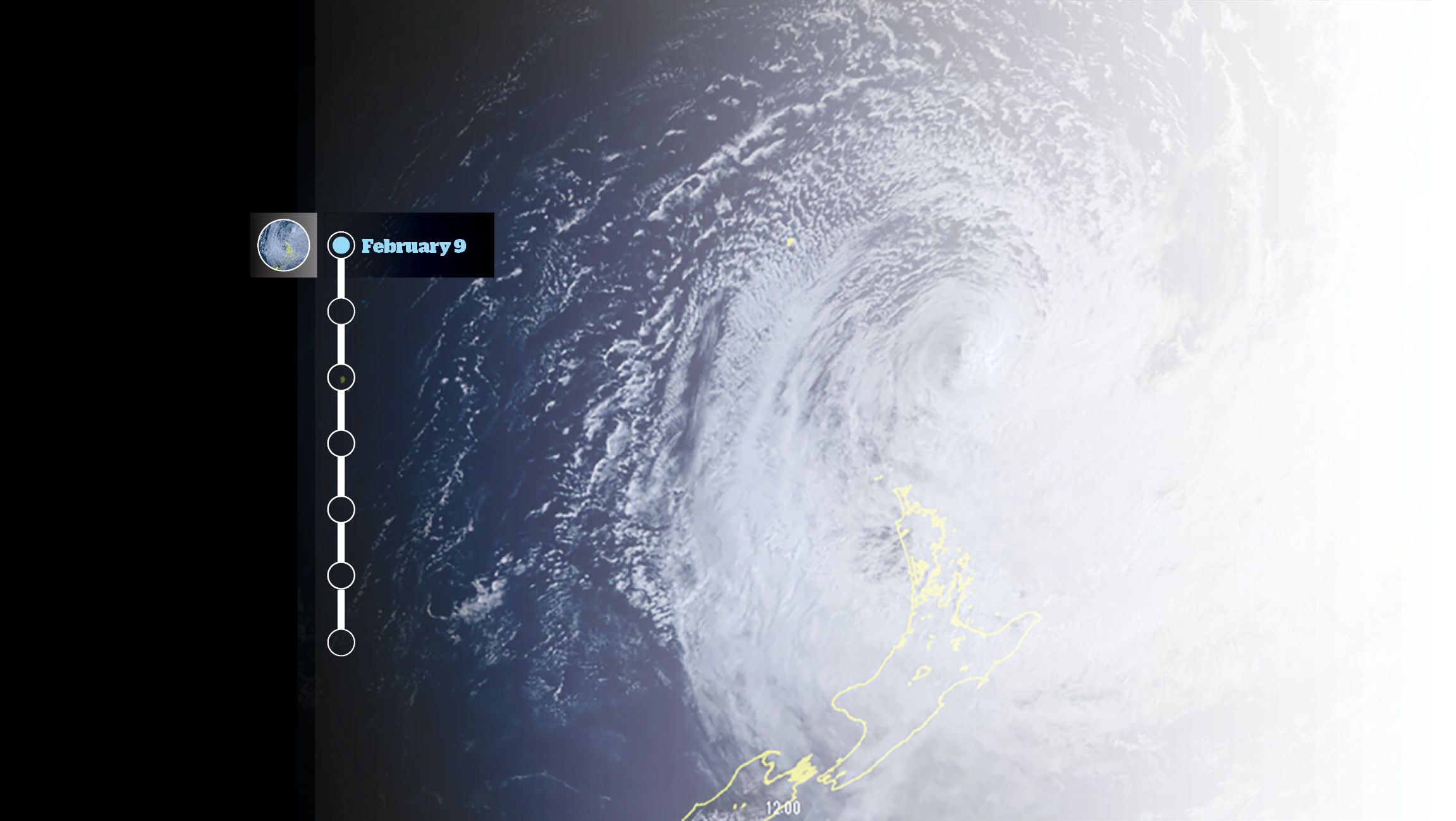
Satellite images of the path of Cyclone Gabrielle. Geostationary Himawari 8 satellite. Photo/JMA
Satellite images of the path of Cyclone Gabrielle. Geostationary Himawari 8 satellite. Photo/JMA
"Looks like it may be impacting Hawke’s Bay late Monday/Tuesday/ "With [the Primary Group Controller] away I’ll be leading some of the preparatory phase on a
'just in case’ type basis."
"Drafting email to mayors, CEs and controllers to be sent out “approx 10am" Friday Feb 10... “I’d recommend having a look at your calendars next week and coming up with some wet weather contingency options for your activities on Tuesday and Wednesday.
“For now team, it’s important that we demonstrate a calm but competent position of always being prepared without overreacting or inciting fear.
"Uncertainty of volume of rain and tracking of cyclone means 'I’m building this uncertainty into my decision making of taking a precautionary approach."
Hawke's Bay Today note: HBCDEM primary group controller Ian Macdonald was on annual leave for a Fiordland tramping trip and out of mobile coverage from Feb 9 to late Feb 13. Questions about this have been addressed here.
February 10
8:39am: HBCDEM Alternate Group Controller and/ Duty Response Manager to CDEM Group joint committee, council CEs and Local Controllers.
“Under the general response principle of ‘think big, act early’ I intend on taking a precautionary and proactive approach to this highly public weather forecast."
“My immediate focus is primarily threefold:
“1. Fostering our communities’ preparedness by encouraging people to take practical steps centred around keeping safe.
“2. Reinforcing trust and confidence in Hawke’s Bay’s coordinated emergency management arrangements and systems."
“3. Undertaking contingency/escalation planning and preparedness so that we are ready to respond to any impacts caused by TC (Tropical Cyclone) Gabrielle.’’
9:53am: HBRC Flood Forecaster to HBRC Team Leader Hydrometric Network:
“Just checking to see if there are any telemetry issues preceding the oncoming rain and wind."
10.04am: MetService issues Severe Weather Watch:
Heavy Rain Watch: Valid: 48 hours from 6:00 am Monday to 6:00 am Wednesday
10:14am: Reply from HBRC Team Leader Hydrometric Network to HBRC Flood Forecaster.
“Saleyards [rainfall measurement site] is having communication issues (quite normal) and data is late. An HBRC Technician is heading there as we speak to try [to] install new Digital Radio [DMR]."
"If this works hopefully comms will be improved and there will be no need for Saleyards to transfer through a link station.
“We have installed a DMR Radio at Fishers [rainfall measurement site] this week and it has slightly intermittent data transfer so [an HBRC Technician] is heading there now to see if we can adjust the aerial position to improve comms.
“Te Kumi satellite site is three days late. Terepatiki [rainfall measurement site] rainfall up to date but [water level site] not. "
“Digger work to strengthen the pier at Waipunga Br is complete (I think). Our [water level] sensors are correct so all good there."
“Nothing else untoward otherwise as far as I can tell."
Civil Defence response: All telemetry network issues identified here were confirmed as having been resolved by the evening of February 13. The network was later critically impacted by the effects of Cyclone Gabrielle.
1:26pm: Question from HBRC Manager
Environmental Information to HBRC Team Leader Hydrometric Network.

Former Prime Minister Chris Hipkins and Hawke's Bay Civil Defence and Emergency Management Group Controller Ian McDonald surveying Cyclone Gabrielle damage to Esk Valley, north of Napier. Photo Mark Mitchell, NZ Herald.
Former Prime Minister Chris Hipkins and Hawke's Bay Civil Defence and Emergency Management Group Controller Ian McDonald surveying Cyclone Gabrielle damage to Esk Valley, north of Napier. Photo Mark Mitchell, NZ Herald.
Are people available to go to Wairoa on Sunday afternoon with “gauging gear so they are ready for any floods"?
There will be a 10am Sunday meeting when “a decision will be made on the seriousness of the cyclone and if there is a need to activate CD [Civil Defence]."
"If we have no one available for Wairoa then so be it.
“HBRC is trying not to be like Akl [Auckland] and be prepared if necessary."
Civil Defence response: Three HBRC Technicians were identified and travelled to Wairoa for this purpose.
2:04pm: Cr Neil Kirton to HBRC
Incident Response Manager:
“Can we have regular updates, particularly on river levels, posted clearly on the website plus on the HBRC Facebook page etc? These have been hard to find in the past and can give our team here at Hohepa lead time to evacuate if we need to."
2:11pm: Reply of HBRC Incident Response Manager to HBRC Public Information Manager to forwarding of email from Cr Kirton:
“May be useful to do some posts on where to find this information and what rivers are running at etc.
“The bit that is always missing from our river information is knowledge about what the level actually means."
February 11
10:12am: MetService Severe Weather Warning Issued
Heavy Rain Warning - Upgraded from Watch to Orange Warning Valid: 24 hours from 10:00 am Monday
to 10:00 am Tuesday.
10:44am: HBRC Flood Forecaster
Sends out catchment-by-catchment forecast of the potential effects of the event.
1.39pm: MetService Wind Watch Issued
Strong Wind Watch Valid: 24 hours from 6:00 pm
Monday to 6:00 pm Tuesday.

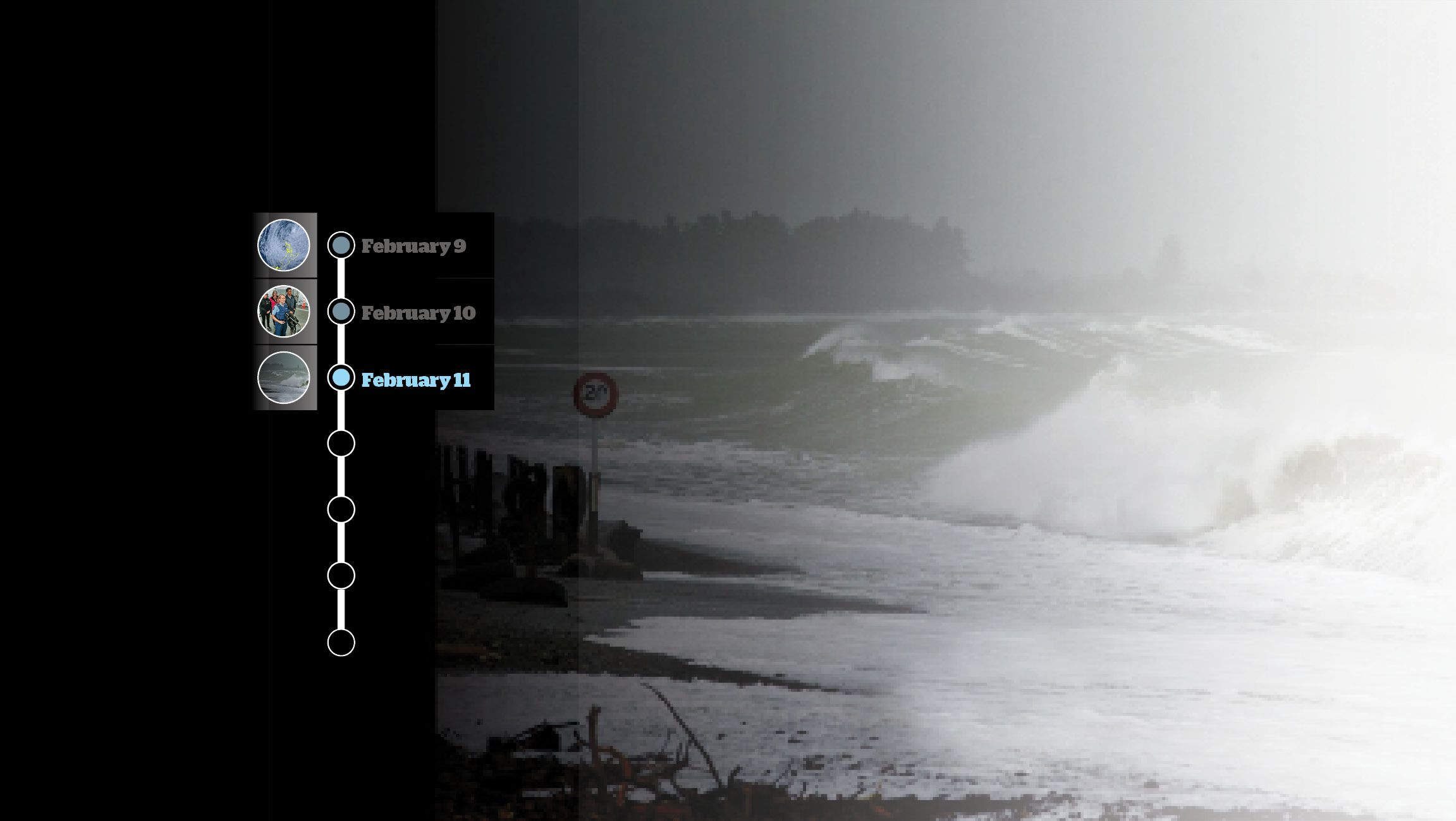
Puketapu Valley in flood during Cyclone Gabrielle. Photo Paul Taylor, Hawke's Bay Today.
Puketapu Valley in flood during Cyclone Gabrielle. Photo Paul Taylor, Hawke's Bay Today.
4:02pm: Alternate Group Controller to volunteer team leaders:
“I wouldn’t think you need to put people on ‘standby’ yet, but doing a quick whip around to gauge who’s around and would be available to respond for [your] own records if we did need to stand anything up is a good idea."
7:38pm: Pieri Munro [Acting CEO of HBRC] to HBRC Incident Response Manager:
“Have just spoken to Kirsti Luke [CEO Tūhoe Te Uru Taumata]. Her concern was the lack of information coming from [staff] at Genesis."
"They have 70 households at Tuai and many people including her own staff using the Great Walk Track.
With the predicted 400ml of rain she is concerned about a two-metre rise of the lake."
"I have advised her that BoPRC (Bay of Plenty Regional Council) and our Flood Control Mgr are talking and we would give her a call to give her any advice on predictions that may influence her Comms to local community and staff."
9:50pm: HBRC Incident Response Manager to Kirsti Luke:
“Pieri Munro called me earlier this evening and advised that you were looking for advice on the lake level, Genesis operations and expected rainfall in the catchment.
"[The HBRC Flood Forecaster] has had a quick look at this and his advice is below:
‘I spoke to [staff] at Genesis – they have about 16% storage capacity remaining in Lake Waikaremoana (i.e. it’s 84% full). They anticipate operating the spilling from that, possibly on Tuesday if the levels rise from the rainfall.
"I also spoke to [a point of contact] from MetService – updated warning will come very soon."
"Significant rain is predicted for Wairoa ranges and south to HB ranges. 250-350 mm. The amount of rain would cause significant risk to trampers and people in risky situations."
"These people should be leaving the tracks if they are tramping. More to come after Met Service update."
"We will [be] reviewing the forecast around 10am tomorrow morning and will provide updated
intelligence through to CDEM.”
Hawke's Bay Today note: Genesis says it released between 35 to 40 cubic metres of water per second from Lake Waikaremoana during Cyclone Gabrielle as required by its consents. There have been claims in Wairoa it released too much, contributing to flooding in town, while in Waikaremoana, Tūhoe has claimed Genesis mismanaged how full the lake was and caused damage as a result. Genesis denies both. Wairoa's flooding is now the subject of an independent investigation.
February 12
8:52am: HBRC Flood Forecaster to HBCDEM Group Office, HBRC Incident Controller and others.
Sends out a catchment-by-catchment forecast of the potential effects of the event.
9:02am: HBRC Incident Response Manager
(replying to 8:52 email):
“Note that I have passed on info re Hohepa to Neil Kirton re consideration to evacuate as they need as much warning as possible. “Also consider Waipataki motor camp – was packed yesterday?!’’
9:08am: HBRC Alternate Group Controller reply:
“I’ve also just called HDC Controller - an early heads up and he’s going to be activating his EOC today to start planning for evacuation management."
5:37pm: HBRC Incident Response Manager to regional councillors and HBRC executive managers
The email provides weather summaries for Hawke’s Bay by catchment and itemises HBRC responses or preparedness and then lists concerns at the end:

Rissington bridge photo taken the afternoon before Cyclone Gabrielle flood on 14th February 2023. Photo Warren Buckland, Hawke's Bay Today.
Rissington bridge photo taken the afternoon before Cyclone Gabrielle flood on 14th February 2023. Photo Warren Buckland, Hawke's Bay Today.
Concerns
"HBRC is keeping a close eye on a number of locations
"Esk, Te Ngarue and Waipataki catchments recommending evacuating motor camps on Esk
"Advice to Hohepa to consider self-evacuation - this will occur tomorrow if it occurs"
"Potential flooding Birdwood Ave Taradale working with NCC on solutions
"Performance of Taipo discharge - Gravity with regards to storm surge impact
"Flooding on Mangaone/Rissington
some houses low in the flood plain
"Coastal erosion and overtopping at Te Awanga - may wish to consider safety of this area in overtopping event
"Resilience of Walker Rd Tukituki River to extended flood conditions - determining failure scenario mapping
"Large volume of weed remaining on waterway network leading to blockages - proactive program over the last few days in preparation."
10:13pm: HBRC Flood Forecaster to HBCDEM Group Office, HBRC Incident Controller and others.
Sends catchment-by-catchment forecast of the potential effects of the event. The forecast includes the following comments:
With regard to Wairoa: “5yr to 10yr at river mouth. Way more rain up above Waikaremoana - tramper safety, Tuhoe notifications.”
With regard to the Esk Valley: “Houses on Shaw Road may be at risk” Note: this line of the email is highlighted in colour by the HBRC flood forecaster.
“Likely require Esk Holiday Park evacuation”
“Campgrounds have already been evacuated”
“Check if anyone in Hukarere Girls’ School”
With regard to the Heretaunga Plains
“substantial surface ponding likely”
With regard to the Ngaruroro and Tutaekuri catchments: “High risk places like Mangaone/Rissington, Okawa/Shanley Road, Maraekakaho and any small stream with short time of concentration”
“Worst case for Ngaruroro/Tutaekuri up to 50-year on Tuesday.”
“Concern for Hohepa at river mouth. What advance time do they need for evacuation?”
With regard to the Upper Tukituki Catchment: “50 to 100-year in main rivers, including down to Red Bridge.”
“Still too early to tell for Red Bridge."
10:17pm: Hinewai Ormsby Chair of Hawke’s Bay Regional Council and Chair of the HBCDEM Group Joint Committee to Regional Councillors and
HBRC Executive Leadership Team
“The CDEM Joint Committee met tonight for an update led by [Alternate] Group Controller. The team and local controllers have been working hard and confident in communication of public awareness, preparation for impact and monitoring of the cyclone conditions."
"At this stage it is unlikely that the region will
need to declare a state of emergency, as was the advice by the group controller."
"However, the full impact of rain fall and damage will be better understood tomorrow. The committee will reconvene tomorrow evening for a further update."
February 13
6:07am: HBCDEM Public Information Manager to Local Authority Public Information Managers:
“Our preference is the advertisement of CDCs/evacuation centres to be done locally first (ie. on council Facebook page). Please notify/tag HBCDEM and then we will share to our channels."
“The reason for this is because not all councils want to open and publicise evac centres at the same time."
8.00am: Group Controller activates the Group Emergency Coordination Centre (GECC)
10:15am: MetService Severe Weather Warning Updated
Heavy Rain Warning - Orange
Valid: 24 hours from 10:00 am Monday to 10:00 am Tuesday
Strong Wind Warning - Orange Valid: 18 hours from 6:00 pm Monday to 12:00 pm Tuesday.
12pm: MetService Wave Warning Issued
Cape Turnagain to Mahanga
Valid from 12:00pm 13 February to 2:00am 16 February.
3:15pm: MetService Severe Weather Warning updated
Heavy Rain Warning - Upgraded to Red. No change to predicted volumes of rain.

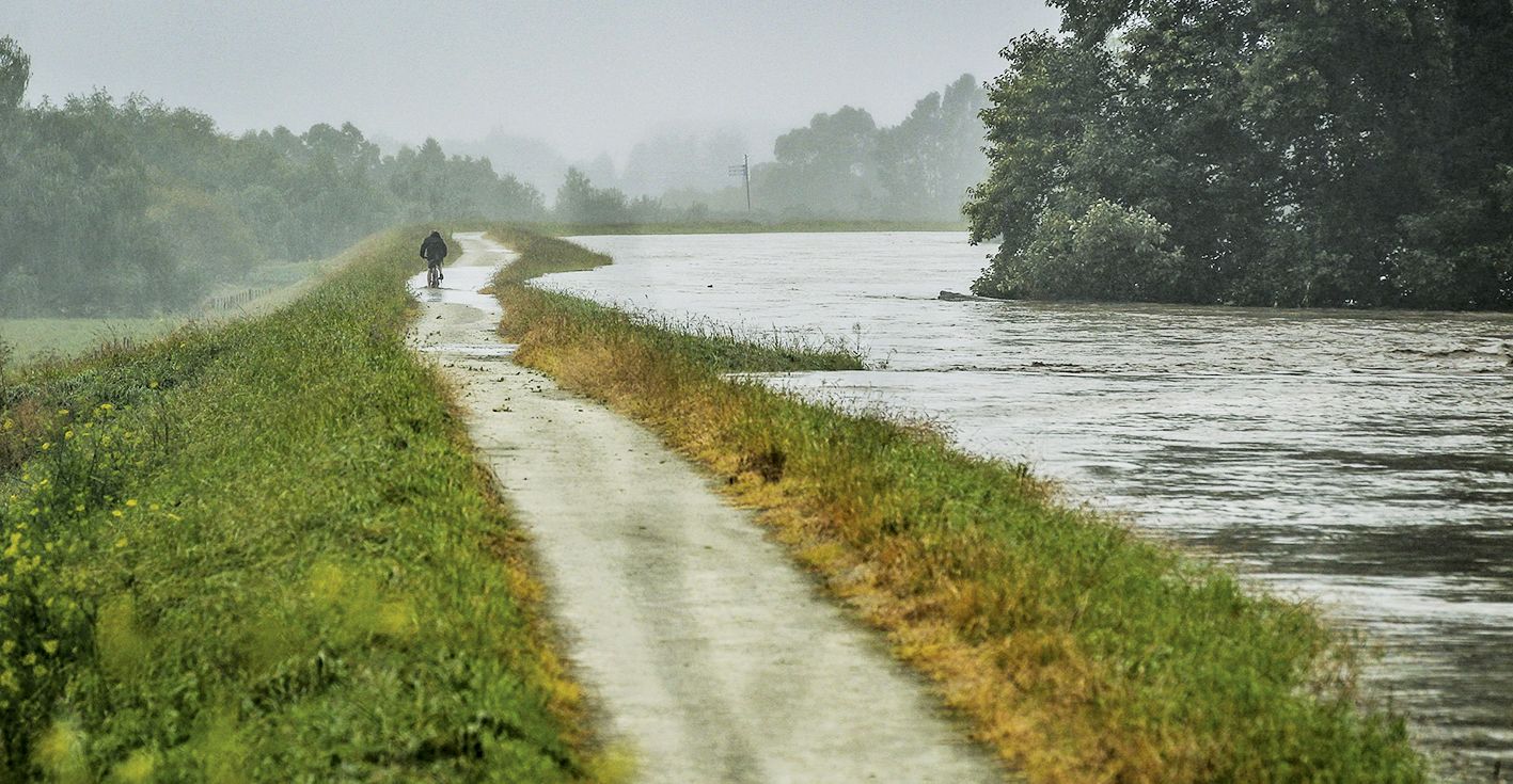
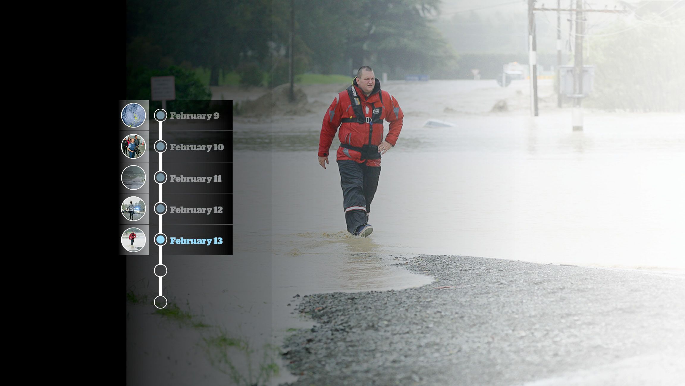
Cyclist passing a small breach on the Tutaekuri river stop bank near Taradale Napier during the height of the Cyclone Gabrielle floods. Photo Paul Taylor, Hawke's Bay Today.
Cyclist passing a small breach on the Tutaekuri river stop bank near Taradale Napier during the height of the Cyclone Gabrielle floods. Photo Paul Taylor, Hawke's Bay Today.
5.35pm: Waka Kotahi NZTA to GECC:
Advises that SH2 is closed at Devil’s Elbow due to a slip, cutting off access to Wairoa.
7:50pm: HBRC Flood Forecaster to Hastings Emergency Operations Centre (EOC) and GECC:
“Esk [River] at Waipunga is at 4.67m at 7pm,
rising fast.
Peak level in 2018 was 7.16m."
7:52pm: HBRC Flood Forecaster to Hastings Emergency Operations Centre (EOC) and GECC:
“Mangaone [River] just passed red level,
still rising very fast.’’
9:05pm: MetService Severe Weather Warning Update
Heavy Rain Warning - Remains Red
Valid: 14 hours from 9:00 pm Monday to 11:00 am Tuesday
9:15pm: Acting Principal Hukarere Girls’ College
Email forwarded to Alternative Group controller by Ministry of Education:
Hostel Girls Transferred to Pukemokimoki Marae
“A short time ago I received a phone call from our Hostel Manager [redacted], who had been visited by police and Civil Defence. As a precautionary measure an evacuation of the hostel has begun."
11.00pm: (approximate): All contact with Wairoa District Council EOC lost – attempts to reestablish communications unsuccessful. Intermittent power and communications outages commence across parts of region.
11:04pm: HBRC Flood Forecaster to Central Hawke’s Bay EOC:
“The situation on the Waipawa is looking rather ominous if all the forecast rain eventuate[s]. "
11:32pm: Group Controller to GECC, HBRC Flood Forecaster, HBRC Incident Response Manager,
and Hastings EOC:
I have "talked to FENZ/Police/HDC staff to clarify if anybody has checked on people out there, if not they will task someone to do that."
Civil Defence response: The term 'out there' likely refers to Esk Valley.
11:50pm: Fire and Emergency NZ to GECC:
Crews have contacted Esk Valley campground and have actioned a self-evacuation tasking at Shaw Road, Eskdale.
February 14
2:10am: HBRC Manager Environmental Information to HBRC Flood Forecaster:
“Burnt Bridge just alarmed at Orange and Folgers Fletchers still rising so it will continue to rise so perhaps warn Waipawa people?"
2:10am: Message from HBRC Flood Forecaster to
Hastings EOC and GECC.
“This will likely be the highest ever measured on Esk" - the message also identifies some additional houses that may be at risk of flooding.
2:25am: HBRC Flood Forecaster to Hastings EOC and GECC:
“Probably best to consider any house in Esk Valley may be at risk."
3:25am: MetService Severe Weather Warning Update.
Heavy Rain Warning – Remains Red
Valid: 8 hours from 3:00am Tue 14 Feb to 11:00am Tue 14 Feb
Strong Wind Warning – Remains Orange Valid: 9 hours from 3:00am Tue 14 Feb to 12:00pm Tue 14 Feb.
4:05am: State of local emergency declared over the Hastings District.
4:20am: Fire and Emergency NZ to Hastings EOC:
All residents of identified at-risk properties in Rissington have self-evacuated to a house on higher ground.
4:31am: State of local emergency
declared over Napier City.

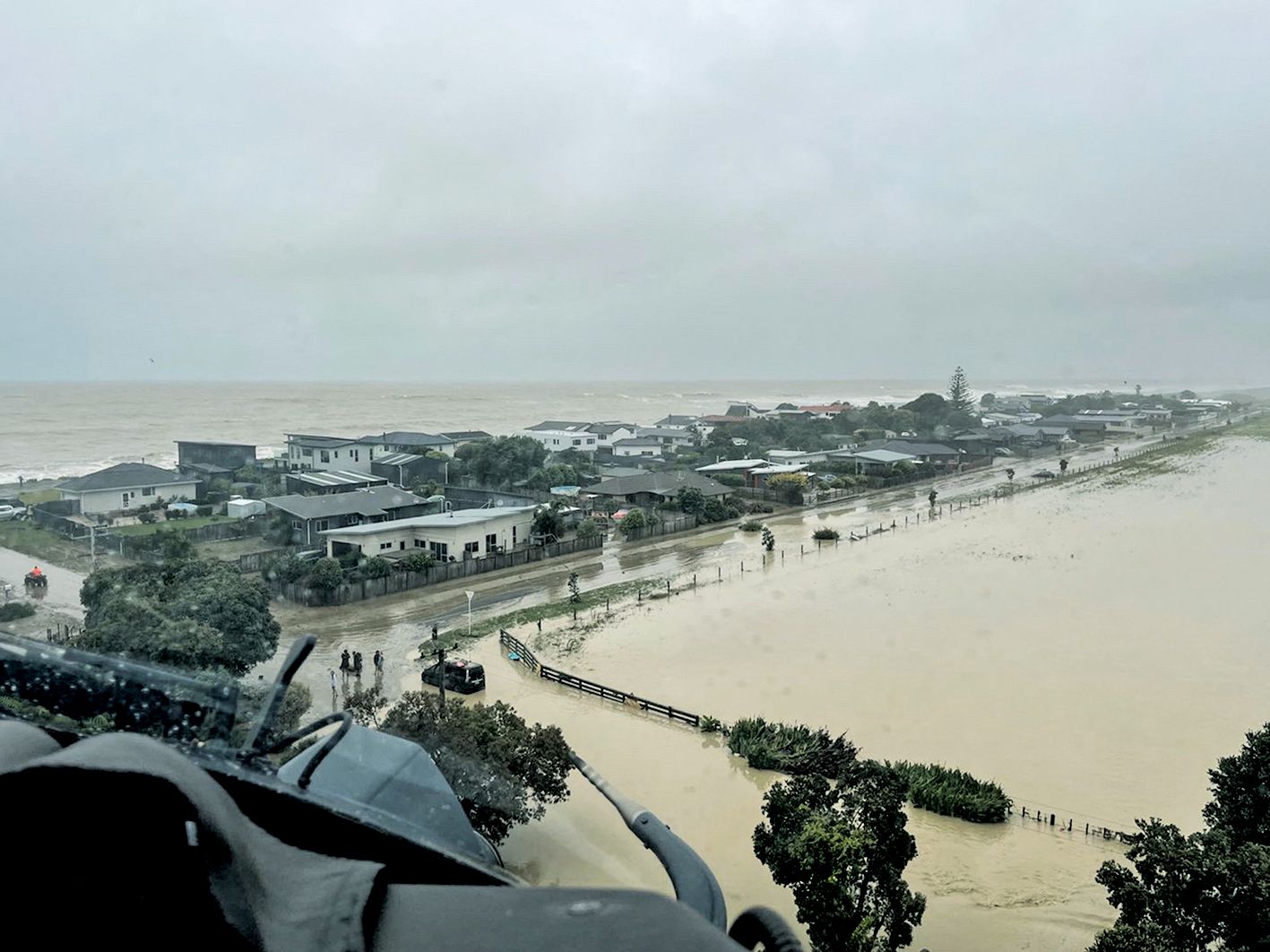
View from a New Zealand Defence Force NH90 helicopter en route to recover people from the rooftops of their homes in the Esk Valley near Napier. Photo NZDF
View from a New Zealand Defence Force NH90 helicopter en route to recover people from the rooftops of their homes in the Esk Valley near Napier. Photo NZDF
5:15am: State of local emergency
declared for Hawke's Bay.
This takes effect over the states of emergency declared over Hastings District and Napier City.
5:19am: Emergency Mobile Alert (EMA) sent:
“There is serious flooding in the ESK VALLEY from the ESK RIVER which is still rising. LEAVE NOW if you are in a low-lying area near the ESK River in Bay View"
6:37am: HBRC Incident Response
Manager to GECC Intelligence.
“Just to advise we are removing part of the stop bank between Taipo stream and lagoon farm to drain Taradale. This will flood lagoon farm - NCC know."
Civil Defence response:
The above action was not implemented.
6:37am: HBRC Flood Forecaster to
Central Hawke’s Bay EOC:
“We’ve had major telemetry failure some time in the night. Our readings on the Waipawa need to be checked.
“There is also major flooding in Esk and Puketapu Bridge has collapsed."
6:41am: HBRC Incident Response
Manager to GECC Intelligence:
“Tutaekuri River running at 1:100 level. “Telemetry river gauges not working -manually checking level."
7:29am: HBRC Flood Forecaster to HBRC Incident Response Manager:
“NG (Ngaruroro River) at Fernhill is still rising. Low tide has passed, this is a major issue."
7:30am: MetService Severe Weather Warning Update
Heavy Rain Warning - Remains Red
Valid: 4 hours from 7:00 am to 11:00 am Tuesday
Strong Wind Warning - Remains Orange Valid: 5 hours from 7:00 am to 12:00 pm Tuesday.
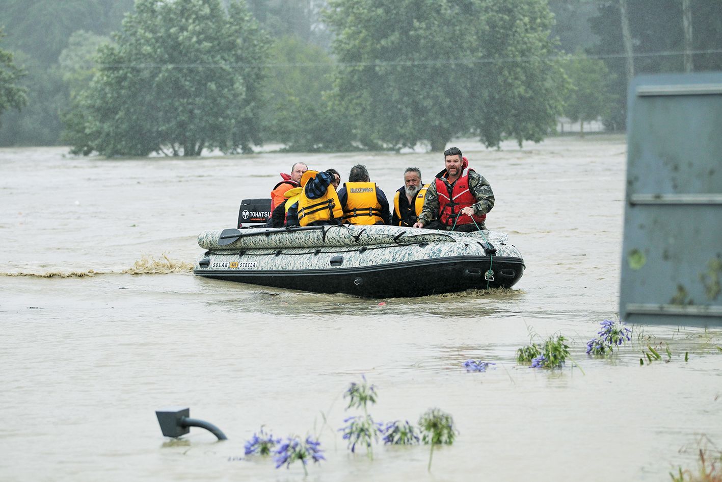
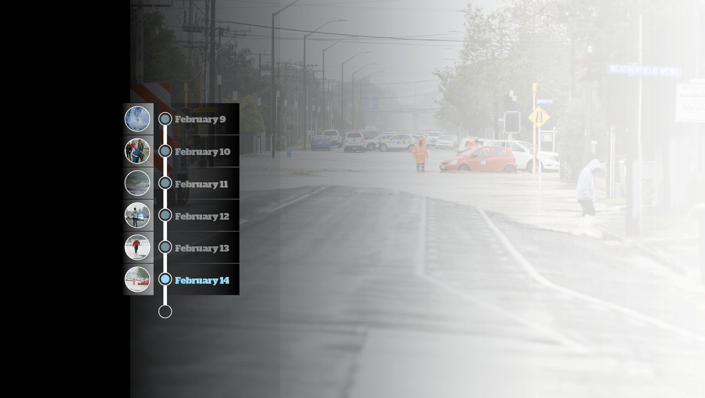
Emergency services and helpers rescue numerous people caught up in Cyclone Gabrielle along Links Road near Taradale after the Tutaekuri river burst its banks. Photo Paul Taylor, Hawke's Bay Today.
Emergency services and helpers rescue numerous people caught up in Cyclone Gabrielle along Links Road near Taradale after the Tutaekuri river burst its banks. Photo Paul Taylor, Hawke's Bay Today.
07:39am: Transpower – total loss of power to Hawke’s Bay.
08:30am: HBRC Status Report to GECC. Includes the following comments:
“Tutaekuri running at 1:100 and rising 100mm per hour
“Puketapu Bridge out.
“Waiohiki Bridge - concern sea container and logs.
“Hydrotel telemetry system not fully operational.
“Flooding in Taradale - removing stopbank between Taipo and Lagoon farm to drain Taradale - machines mobile 1 hr ago.
“Extensive power outages
“NCC have opened both the Taradale and Greenmeadows overflow valves overnight for WW [wastewater] overflows. This will result in some WW overflows into the Ahuriri estuary. Despite this they still getting reports of manhole covers popping.”
8:43am: State of national emergency declared over the Northland, Auckland, Waikato, Bay of Plenty, Tairawhiti and Hawke's Bay CDEM Group Areas.
This takes effect over the state of local emergency declared over the Hawke’s Bay Civil Defence Group Area
8:53am: State of local emergency declared over the Wairoa District.
Civil Defence response: Due to communications outages in Wairoa, officials were unaware that CDEM Group and national declarations had already occurred.
9:29am: HBRC Incident Response Manager to Alternate Group Controller: “Overtopping now occurring opposite EIT - recommend evac."
9:39am: Alternate Group Controller response to 9:29am email: “Underway”
10:12am: HBRC Alternate Group Controller to HBRC Incident Manager: “Get one of your engineers to the Napier Fire Station to get eyes in the air ASAP."
10:16am: Emergency Mobile Alert sent:
“Residents of Taradale and those on the south side of the Tutaekuri River to evacuate and go to higher ground immediately. Flood protection systems of the Tutaekuri River are failing to contain water. Get to higher ground immediately."
10:39am: Emergency Mobile Alert sent:
“Hawke’s Bay Civil Defence Emergency Management Group advise residents of Taradale, Jervoistown and Meanee (sic) residing south and east of Anderson Park to evacuate."
12:38pm: HBCDEM alternate Group controller to mayors and chief executives of Hawke’s Bay councils:

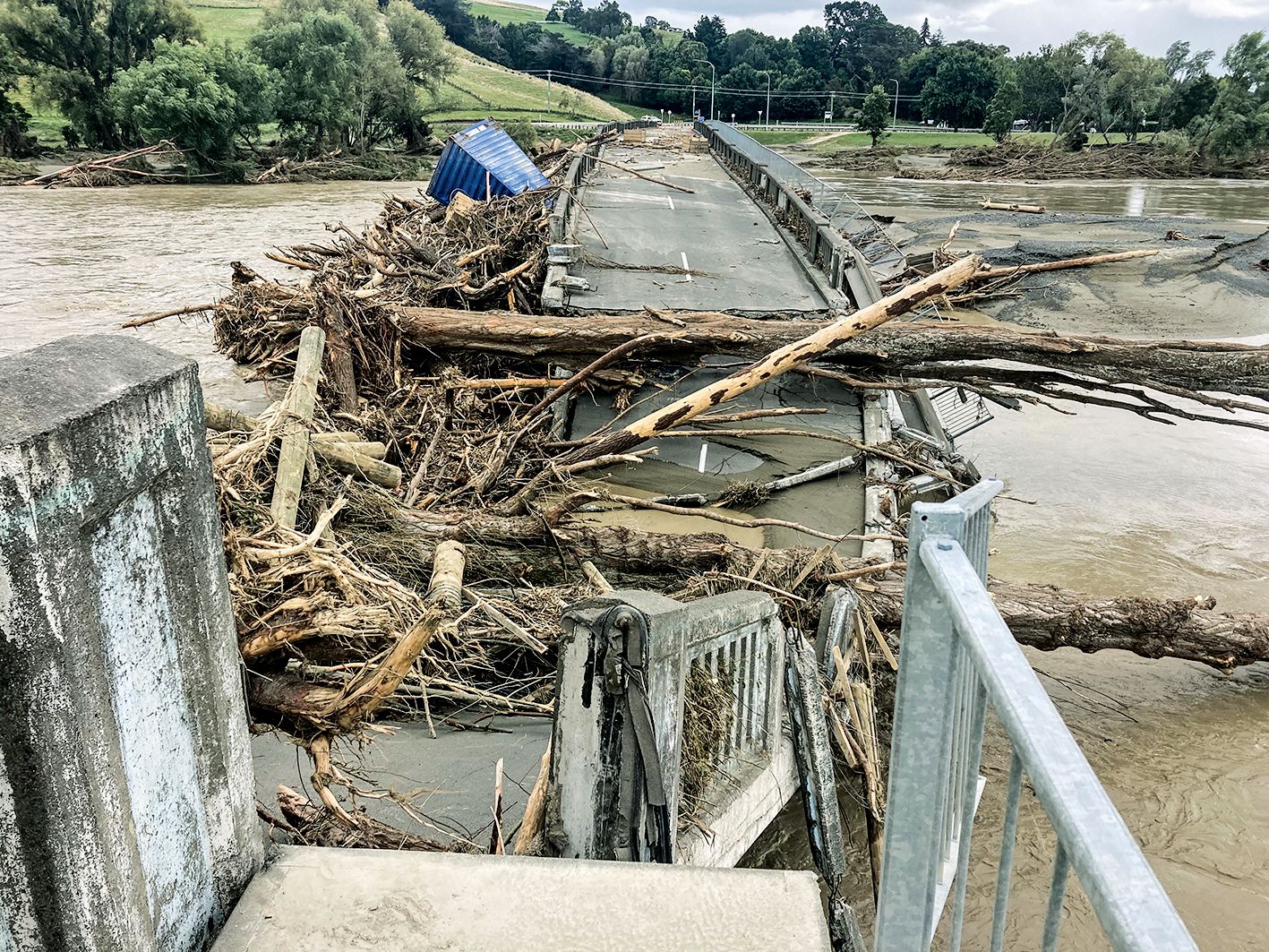
Tutaekuri Bridge at Waiohiki, Napier. Photo Paul Taylor, Hawke's Bay Today.
Tutaekuri Bridge at Waiohiki, Napier. Photo Paul Taylor, Hawke's Bay Today.
“Apologies that this is late, we have been inundated with what I will simply describe as an unprecedented regional scale event.
"This will be the largest incident that regions has [sic] experienced in many years and the impacts are likely to be ongoing and severe on our communities.
"We have limited communications, no reliable mobile coverage. There is a widespread power outage with indications that it will be days or weeks before this is resolved.
"There are multiple roads closed and or bridges lost. Wairoa is effectively isolated.
"Police are managing multiple active rescue situations being managed by FENZ and Police.
"This is the priority and focus, to support situations where life is at risk. Staff are actively triaging intelligence that is coming into us so that we can respond to the highest risk and highest priority situations.
"We have FENZ and HBRC staff in the air to assess critical flood infrastructure and people at risk.
"We ordered an evacuation of parts of Napier due to imminent threat of the stop bank overtopping at Waiohiki.
"HBRC staff are assessing the condition of the stop banks and we might be able to allow people to return home soon.
"The Ngaruroro is over topping at Omahu and I ordered the evacuation of that community. We are working hard now to stand up as many CDC's as we can and to manage logistics around food and clothing.
"Fuel supplies are being managed to ensure that we can supply essential services. NZDF are sending staff and vehicles and the airforce NH90 is either on scene or will be shortly to support rescue efforts.
"We plan to use this to do a wider survey of the region to work out what we don't know, as there are many parts of our region that we cannot communicate with nor access.
"We are supplying as much information as we can via the PIM team but are seriously hampered by a lack of communications.
"We are supplying the media as much as we can as we can (sic)."
10:52: MetService Severe Weather Warning Update.

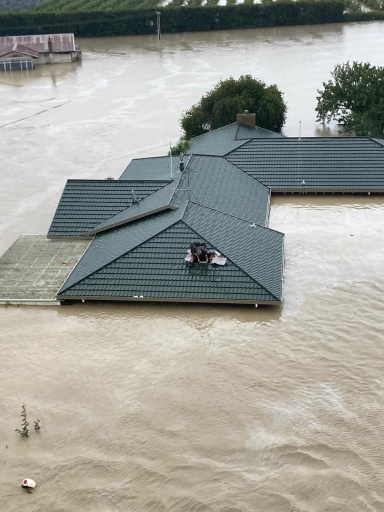
Cam Taylor needed an axe to rescue some people from their roof cavity. Photo Supplied.
Cam Taylor needed an axe to rescue some people from their roof cavity. Photo Supplied.
Heavy Rain Warning no longer in force. Strong Wind Warning no longer in force.
2:57pm: MetService Severe Weather Warning Issued
Heavy Rain Warning - Orange
Valid: 13 hours from 1:00pm Tuesday to 2:00am Wednesday
8:56pm: MetService Severe Weather Warning Update
Heavy Rain Warning - Remains Orange Valid: 6 hours from 8:00 pm Tuesday to 2:00 am Wednesday
10pm: HBRC Status Report to GECC. Includes the following comments:
“Mission pumpstation breach - water is filling Awatoto
“Mission and Brookfields pumpstations are not operational - they are under water
“Major infrastructure issues across the district. SH 2 north and south damaged. SH5 damaged. Damage in a number of locations long term and will take week/months to repair”
“Hospital is at capacity with ongoing medical evacuations for various locations.
"Air Force and Rescue Helo working.”
February 15
2:26am: HBRC Intelligence to GECC.
Update to status report
"2am: Kenny Road Pumpstation has come up another 40mm in half an hour. Unsure whether high tide at
01:13 is having an effect."
Delivering supplies to a stranded mate across the Esk River in Eskdale after Cyclone Gabrielle. Photo Paul Taylor, Hawke's Bay Today.
Delivering supplies to a stranded mate across the Esk River in Eskdale after Cyclone Gabrielle. Photo Paul Taylor, Hawke's Bay Today.
“Tutaekuri level at bridge at 01:30 at Waitangi
has dropped 1m in 4hrs."
“This would indicate that the large area of ponding from previous burst stop bank is still flowing in northerly direction through the golf course and has the potential to further inundate the Te Awa Ave and Estate area."
A note from Hawke's Bay Today editor Chris Hyde:
The aim of pulling together this timeline was to create an accurate record that provides some clarity for readers, and it has taken significant time to do so.
Before publication senior editors made the unusual call to put everything that we found of interest for the timeline in front of Hawke's Bay Civil Defence Emergency Management.
HBCDEM is facing three separate reviews into its performance and has been reluctant to respond to critiques of it, pending the reviews.
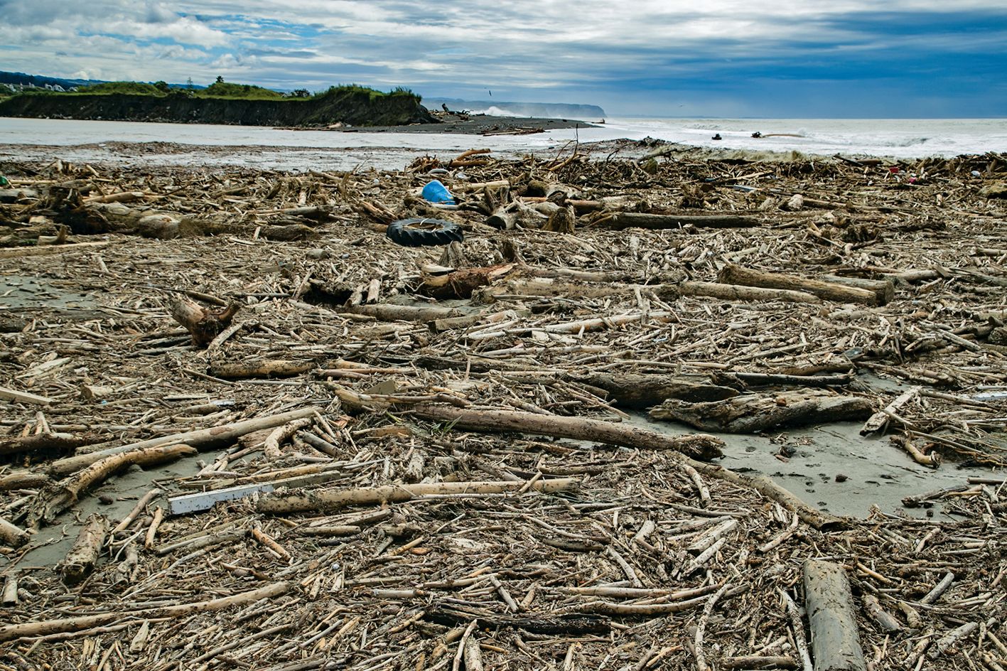
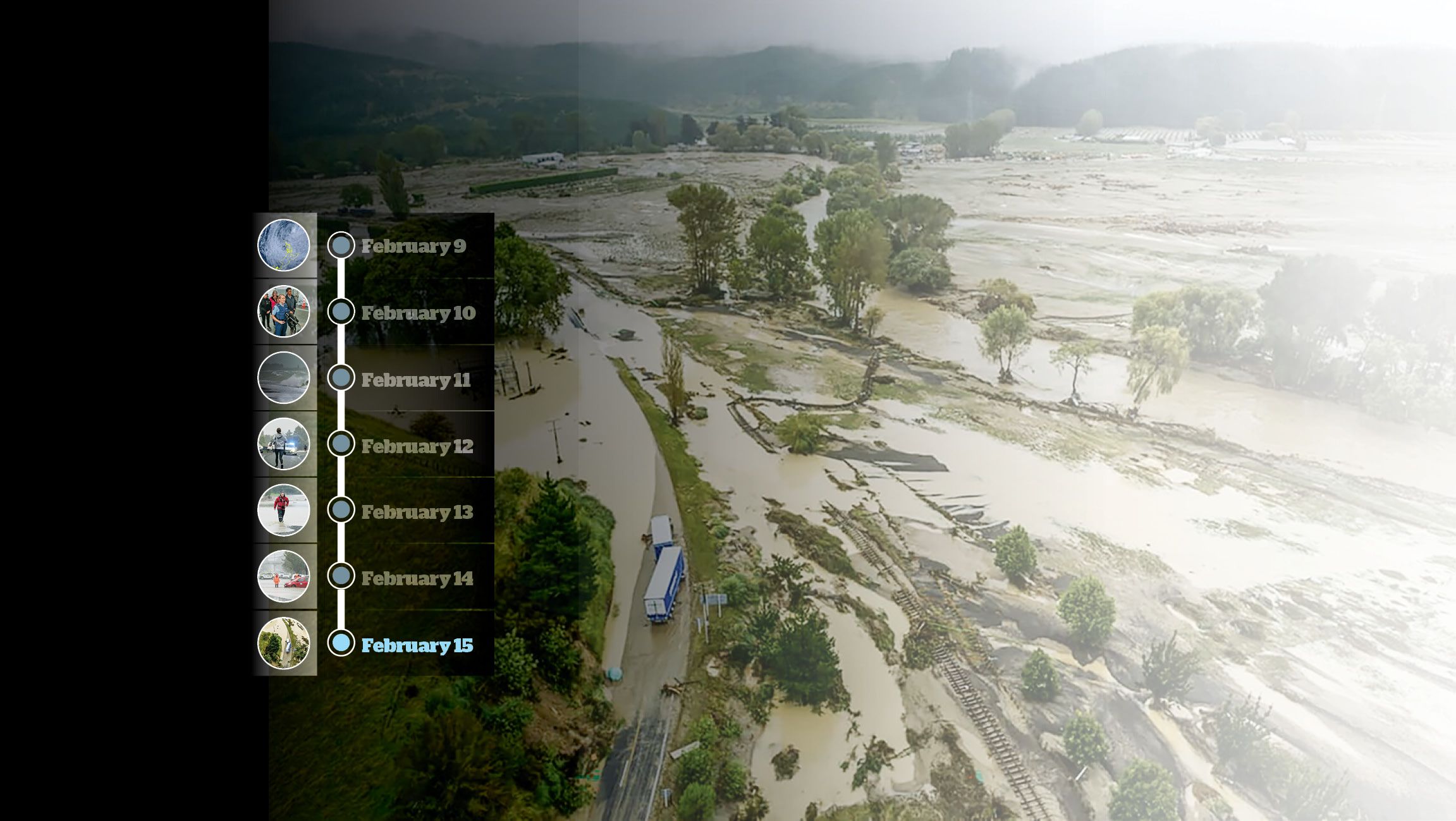
Slash litters the Esk Rivermouth and beach after being washed down the river during Cyclone Gabrielle. Photo Warren Buckland, Hawke's Bay Today.
Slash litters the Esk Rivermouth and beach after being washed down the river during Cyclone Gabrielle. Photo Warren Buckland, Hawke's Bay Today.